Sociale media

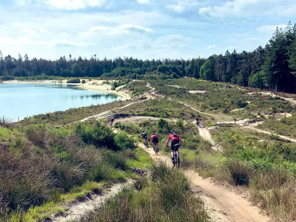
Mountain biking in the beautiful and adventurous Drenthe
Hotel Abdij de Westerburcht is located in the center of Drenthe. Surrounded by beautiful forests and heather fields, the Westerburcht is the ideal starting point for various mountain bike routes. We offer a cleaning place for your mountain bike and offer a lazy checkout based on availability. So you can go on an adventure early in the morning and use a lovely shower when you return.
VAM-berg Wijster
Starting point: Abdij de Westerburcht
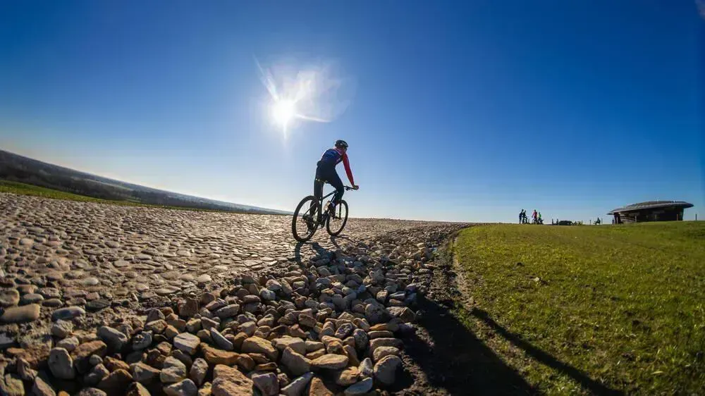
The route is located on the VAM mountain in Wijster. VAM is an abbreviation for 'Vuil Afvoer Maatschappij' (waste disposal society), this is because the VAM mountain is a former waste processing company. The VAM mountain is covered with clean soil and grass and is about 56 meters high. When you climb the Col du Vam you reach a height of about 37 meters, where you can enjoy the fantastic view of the area.
There are now 3 climbing routes and 1 descent open on this hill. The climbing routes are 2,100 m long with an average gradient of 10%, the northern climb ends in cobbles up to 15%.
This route is for the real sports enthusiasts. The route will partly consist of stones, but there is also a platform path of 300 meters. In addition, the course also contains a special (floating) water bridge.
Sleen 32.2 km
Starting point: Recreation lake De Kibbelkoele, Middelesweg, Noord-Sleen
approximately 15 minutes by car from the hotel
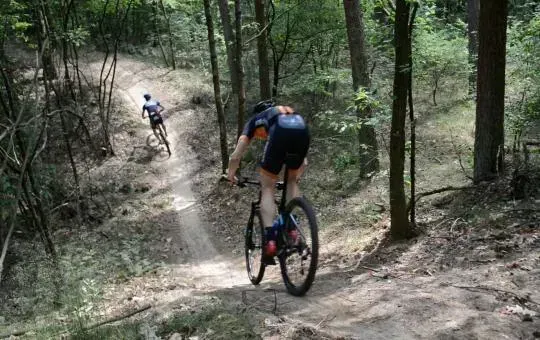
Soon after the start, your mountain biking skills will be put to the test by a winding single track over short succession hills. The height differences were caused by drifting sand from the period when the area was still heather.
The mountain bike route largely runs along the edge of the forest. This is to give the game some rest in the middle. After a few kilometers you will encounter a real mogul slope on the route. There are few height differences in the further part of the route. However, handy use was made of some drainage channels in order to get some height difference in the route. This part of the route consists of an alternation of wide paths where you can take a breath and fun, technical single tracks. Regularly look out over the wide Drenthe countryside next to you.
At the end of the route you will pass swimming pool De Kibbelkoele. Here you will finde a very technical single track that requires a lot of turning and where you can enjoy small, steep climbs and descents.
Gieten - Gasselte 29.9 km
Starting point: Parking at Buitencentrum Boomkroonpad, Steenhopenweg 4, Drouwen
approximately 20 minutes by car from the hotel
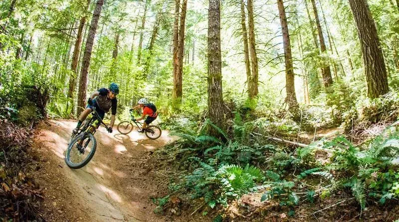
The fairly challenging mountain bike route largely leads through the forests of Staatsbosbeheer. Various types of paths are used. Wider sandy paths, beautiful winding single tracks and short climbs alternate. Use of paved roads is kept to an absolute minimum.
Despite the fact that it is relatively flat in Drenthe, the route uses a lot existing hills and slopes. The banks of two former sand quarries have been fully utilized. The paths that have been created here have some steep climbs with a beautiful view over the blue water as a reward.
The content of single tracks in the route is high, for example, a beautiful flow trail has been made to / along the N34 at Gasselte. To maintain speed, curves have been used throughout the route.
There are 2 options to shorten the route. This is indicated by the black MTB sign.
Dwingeloo 21.9 km
Starting point: Orientation Center Spier, Oude Postweg 12, Spier
approximately 15 minutes by car from the hotel
The Dwingelderveld is a varied nature reserve. The mountain bike route consists mainly of forest and sandy paths and is 80% unpaved. The route builders have tried to include the slopes in the terrain in the route as much as possible. After about 6 kilometers you go through a metal gate. Sheep and cattle graze in this area. They must ensure that the grass and saplings are kept short.
About 600 meters further there is a striking sign. You will then enter the area of the radio telescope. Along this part of the route you will also find various works of art, created by artists from different countries. The northern part of the route is much flatter and mainly follows long, wide forest paths, occasionally interspersed with small stretches of singletrack. In the most northern part of the route, the route is a bit parallel with the A28, which you will see on your left through the trees. After some wide paths and a few pieces of singletrack you will be back at the information center after 23 kilometers. The route is not difficult.
Appelscha 16.1 km
Starting point: Het Groote Veen car park (Bosweg), Appelscha
approximately 20 minutes by car from the hotel
The mountain bike route alternates on somewhat wider paths, but there are also nice stretches of single tracks. Because this is a fairly flat area, you will find little differences in height in the route. Nevertheless, the route makes full use of the small height differences that can be found in the terrain. The route contains short technical parts with small climbs and descents.
The environment in which you drive is very varied. The route takes you past a large heathland and various pools. You also cycle over a large plain where you have a wide view, also nice single tracks have been included in this part. After cycling through the forest for a while you will pass the Aekingerzand. In the Drenst-Friese Wold there is also a real flock of sheep and cows grazing. So make sure you don't run over a cow or a sheep! The last part of the route goes through the forest again with alternating somewhat wider paths and nice winding single tracks.
The route is not difficult in itself. If you drive it in combination with the red route of Appelscha and / or the green route Diever / Hoogersmilde, you can speak of a fairly intensive and varied route.
This route can be followed continuously with the 4 kilometer long red route (Appelscha-Bosberg) and the 28 kilometer long route in Diever / Hoogersmilde.